Product description
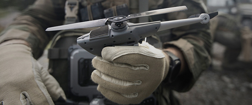
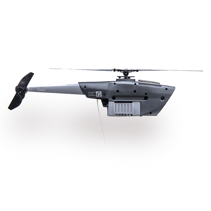
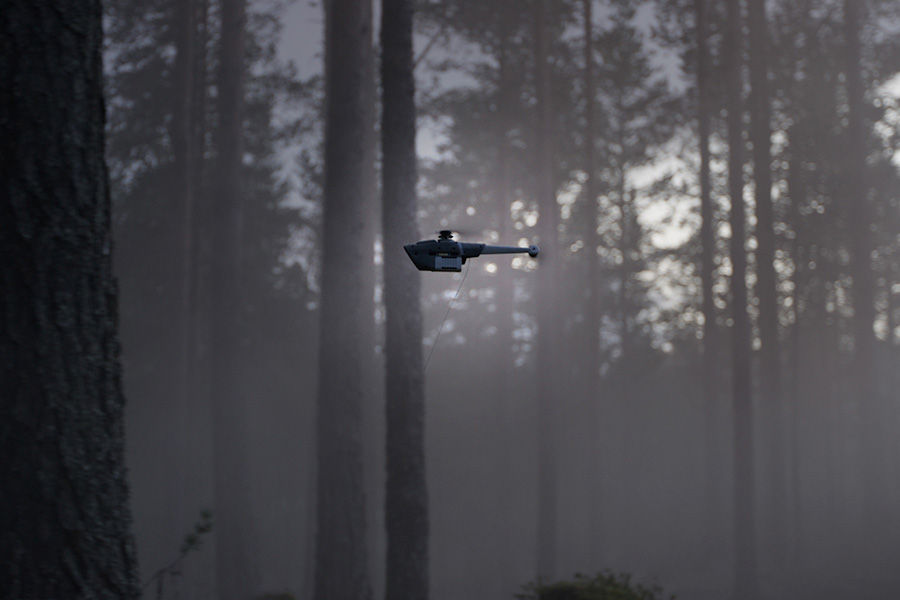
Teledyne FLIR Black Hornet 4 nano droneThe Black Hornet 4 is a further development of its predecessor, the Black Hornet 3, and represents the next generation of nano drones. Equipped with a new 12 megapixel day vision camera, which delivers outstanding results even in low light conditions, and a high resolution thermal imaging sensor, it offers the user razor-sharp videos and photos in real time. Despite its light weight of just 70 grams, Teledyne FLIR’s latest drone can stay in the air for over 30 minutes and cover a distance of over two kilometers. It is ready for use in less than 30 seconds and can withstand wind speeds of up to 46 km/h – and even up to 55 km/h in gusts.
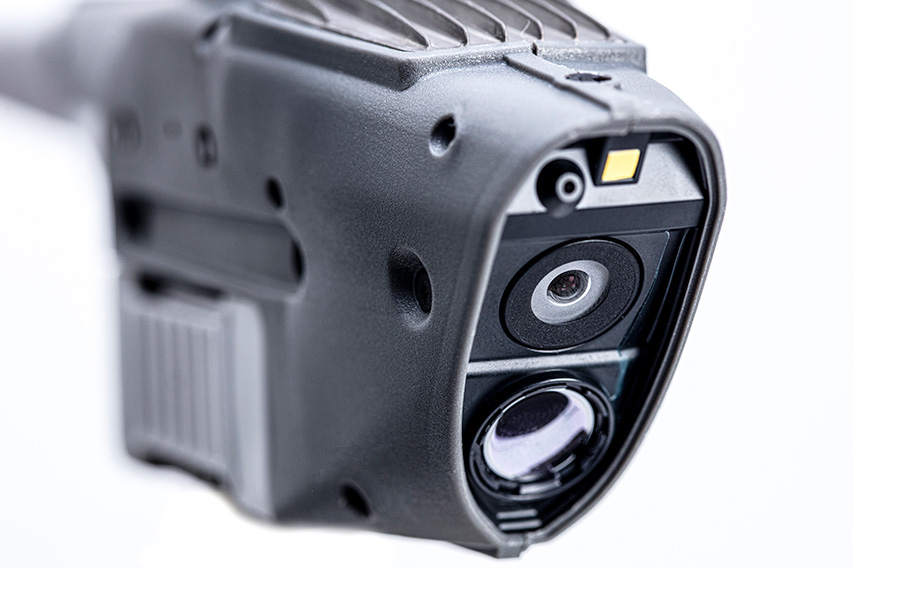
The high-resolution thermal imaging camera with 640 x 512 pixels (TI) for video and photos, the 12-megapixel electro-optical camera (1280 x 720 px video/2316 x 1746 px photo) with excellent low-light capabilities and the powerful Qualcomm processor combined with three navigation cameras offer outstanding performance both day and night. The integrated collision avoidance is able to detect obstacles precisely, both indoors and outdoors. This not only helps to increase the safety of the system, but also optimizes efficiency during operations.
Technical data
Product benefits
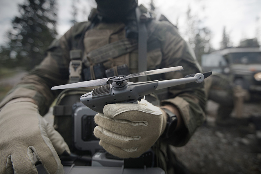
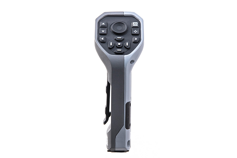
Intuitive operation
The operator software and hardware is designed for intuitive handling and enables fast and efficient use.
State-of-the-art technology
State-of-the-art sensors with high performance deliver precise image and video data in real time, day and night.
Higher speed and longer flight time
The next generation of the Black Hornet nano drone achieves a flight speed of up to 36 km/h. The flight time has also been increased to over 30 minutes.
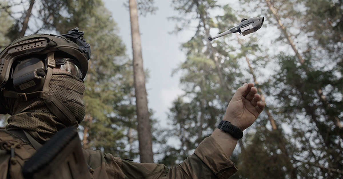
Possible usage
Unmanned aerial vehicles (UAVs) are used for both civilian surveillance tasks and military reconnaissance missions and are often part of a comprehensive system of networked devices. These complex operational scenarios require state-of-the-art technologies to provide emergency services and tactical units at all levels with a rapid and complete picture of the situation.
Additional information
Automatic flight mode
Users can let the system autonomously fly routes and waypoints or manually control it themselves at any time. In automatic flight mode, the operator can assign tasks to the drone at the predefined waypoints (e.g. “orbiting” or “recording from a certain angle”). Mission planning can be dynamically adjusted in flight.
Integrated safety systems
The Black Hornet 4 has modern, configurable safety systems. This allows the flight altitude, which the drone automatically assumes in the event of a loss of connection, to be adapted to the circumstances. The Black Hornet 4 also has the ability to automatically return to the defined landing point after a connection is lost (return-to-home function).
Use in GNSS free flight
This technical feature allows the device to be used even in contested GNSS conditions, such as when the GNSS signal is disturbed or spoofed. This ensures reliable navigation even in challenging environments. Precise position data can also be used in the event of active interference.
Low acoustic and visual signature
Due to its compact design, the Black Hornet 4 has an extremely minimal acoustic and visual signature. The extremely low volume of around 20 dB at a distance of 30 meters enables covert reconnaissance and surveillance operations with minimal risk of detection. This significantly improves the chances of successful missions.
Autonomous or manual – dynamic mission planning in flight
Users have the option of letting the system fly routes and waypoints autonomously or controlling it manually at any time. In automatic flight mode, the operator can assign tasks to the drone at the predefined waypoints (e.g. “circle around” or “shoot from a certain angle”). Mission planning can be dynamically adjusted in flight.
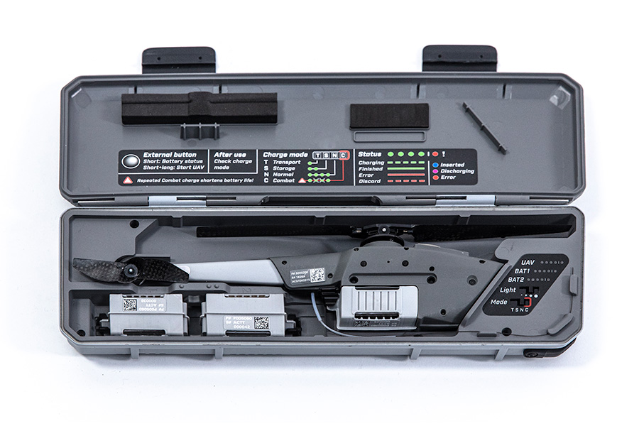
Secure storage and charging system
The drone is stored in a robust housing. This so-called hangar (IP65) is equipped with internal charging devices and offers space for two spare batteries, which are charged in parallel with the drone. This makes it possible to maintain continuous flight operations with a single system.
The data connections are initialized in the hangar without the need for an external power supply.
This product is available from ELP GmbH in the following countries:
Germany, Austria
Your contact person is there for you
Do you have any questions, requests or suggestions?Error: Contact form not found.